South East Australia
Along the coast from Adelaide to Byron Bay
|
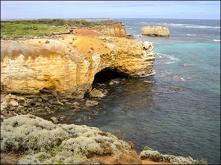
Watching koalas, sea lions and caves on Kangaroo Island. Via pink salt lakes and dry plains on the Great Ocean Road along cliffs and rock formations, ending up - via deserted bays and tropical rainforest - in Sydney to climb the Harbour Bridge. Via the waterfalls and eucalyptus forests in the Blue Mountains on to Byron Bay, a surfers paradise in the most eastern spot of Australia.
Travelogue & photos: Wim van den Broek
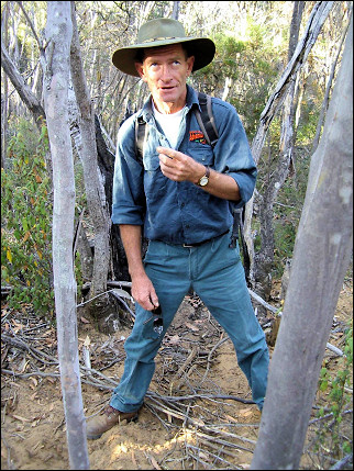
On the morning after our arrival in Adelaide we leave for Kangaroo Island. Our guide for the next few days, Mike, picks us up with a 4x4 van with trailer. Mike looks like an Australian ranger, green suit, big brown hat.
Kangaroo Island
Koalas, wallabies and sea lions
|
Via Fleurieu Peninsula we drive in one and a half hours to Cape Jervis. From this farthest end of the peninsula a ferry leaves to Penneshaw on Kangaroo Island.
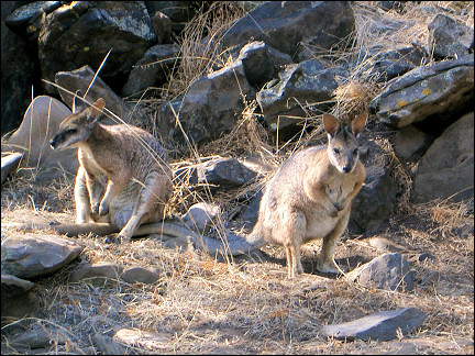
There we drive to a forest where a wallaby colony lives. It's hot, so the animals stay in the shadow between the bushes. Wallabies turn out to be small kangaroos and not shy at all.
|
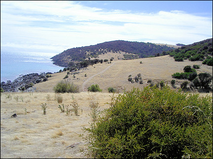
We continue our trip to Prospect Hill, a sand hill (110 m). Matthew Flinders, the Brit who discovered Kangaroo Island, thought that what he saw from this hill was the mainland, hence the name Prospect Hill. We have a view of the southern ocean. The island is only 1 km wide here.
After driving another 5 km we leave civilization and turn onto a sand road. With a large dustcloud in our wake we race to Cape Linois in the outback of Kangaroo Island.
|
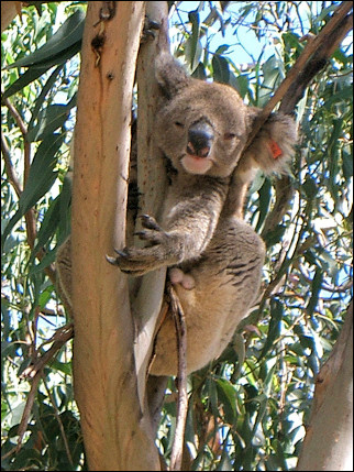
After lunch we visit Little Sahara: a vast sand plain in a forested landscape. Then we cross the island, on hardly accessible roads where iguanas cross our path. The trip ends at a koala colony.
Koalas are a plague for the eucalyptus trees on the island. Most have been brought to the mainland by plane. Of the remaining koalas on the island many are neutered to keep the island population withing certain limits.
Normally the animals would have been shot, but their cuteness - and thus the foreseeable public protests - have kept the Australian government from doing this.
We spend the night on a sheep farm, where we are welcomed by screaming cockatoos. On our way to bed, we cross paths with a 2 m high male kangaroo. We stop, keep a distance of 3 meters and wait until he hops away. The farm is on the edge of Flinders Chase National Park where lots of kangaroos live. The farm has much food they like: wheat and hay.
|
At six AM we leave for the starting point of the Ravine des Casoars Wilderness Trail. Before we can begin our 9 km hike, we have to disinfect our shoes. Otherwise, we run the risk of bringing a virus which is dangerous for the indiginous flora (phytopheria).
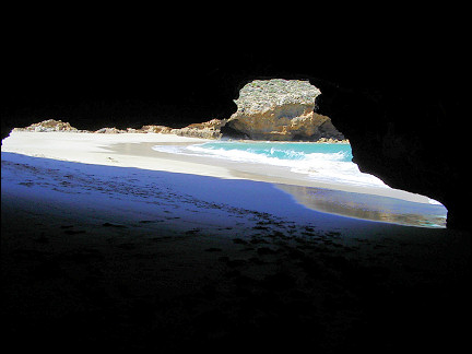
We walk along the bed of a small river to the Limestone Cave which sits on a deserted bay with white sandy beach, azure sea, meters high surf and on both sides caves where pinguins have their nests.
|
On the way back Mike points out a common tree on the island: the grass tree (related to the yucca). This tree protects itself against forest fires by causing an explosion which keeps the fire away from its kernel.
Its trunk is charred: 8 years ago there was a major forest fire. At the top of the trunk grow green twigs. Some of these trees are over 3 meters high, which means they have to be over 300 years old: the tree grows only 1 cm every year.
Other trees and plants also have ways to defend themselves against fire. One of them even hopes there will be one: its seeds only spread during a forest fire.
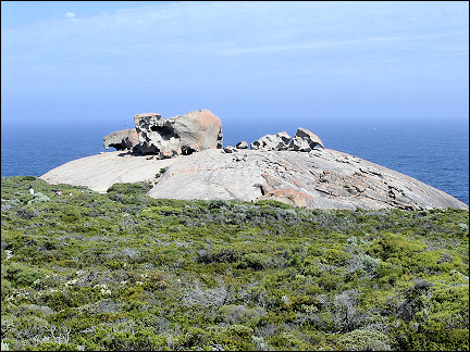
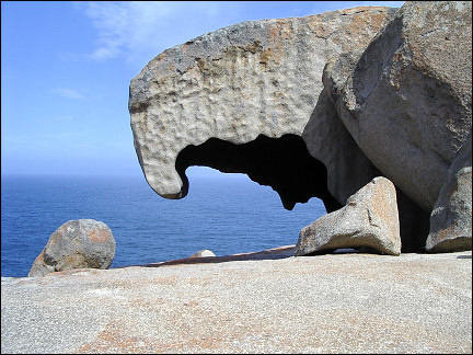
We continue our drive through Flinders Chase National Park, where kangaroos and iguanas cross the road, on our way to Remarkable Rocks. It is a granite rock formation, shaped by wind and salt water.
|
We visit Admirals Arch: a colony of hundreds of sea lions, sleeping on the rocks. Our next visit is to a platypus colony. They are supposed to hide in the twelve little lakes around here.
We have to be quiet to see them. But that doesn't help, during the three quarters of an hour that we are here they don't show themselves.
|
On our last day on Kangaroo Island it is overcast. We take a 9 km walk from Hanson Bay along rivers, lakes with ibises, over hills and through all but impenetrable woods, toward Kelly Hill Caves. Mike accompanies us during the first 3 km, then returns and drives the van to our arrival point.
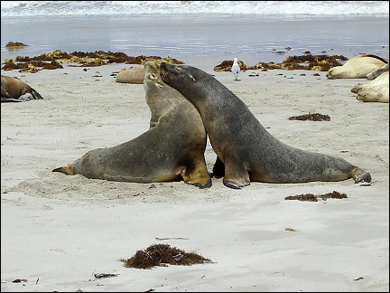
Our last visit is to the sea lion colony in Seal Bay. You are only allowed to enter the beach with a guide to see the sea lions from close up. Mike takes us to a distance of only 3 meters from the sleeping, playing, idling and suckling animals. It is hard to believe that a 300 kg male sea lion allows us to get this close.
|
It is hard to make an estimate of the population. They live solitary, go hunting individually for 3 days in a row, sometimes over 50 km off the shore, to end up exhausted on a beach. If they end up in a different colony, they are immediately accepted.
A sea lion who sticks up its head is not displaying macho behavior, as we thought; the meaning is unknown. Researchers call it "seal yoga".
After an uneventful ferry trip back to the mainland, Mike takes us back to Adelaide.
South Australia
Pink salt lakes and dry plains
Next morning we pick up our mobile home. Driving on the left side of the road appears to take some getting used to, as does changing gears with our left hands. We drive to a camping site in Murray Bridge, 80 km south-east of Adelaide.
|
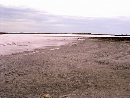
Next morning we leave for the coast, southward. The roads are narrow, especially for our mobile home. We pass many salt lakes. They are pink because of a bacteria in the salt. We eat lunch near a pelican nesting site. Unfortunately we can't get close to the birds.
Back on the road, the vegetation changes: shrubs on the sides of the road and behind those endless dry fields with every now and then a lone tree or cow. The mailboxes along the road are the only signs of human habitation. They must live out of sight, behind the horizon. Some farmers use old refrigerators as mailboxes; they certainly can hold a lot of mail.
|
Via Beachport, a deserted town on the southern ocean, we drive to Port Campbell, a likewise deserted town on the most southern road of Australia, the Great Ocean Road. On the way the vegetation changes from dry to green; many sheep and cow farms. Farmers are gathering their cattle with a trike, a glorified 4-wheel skelter.
At crossroads there often are only a few houses. We drive for many kilometers through a vast forest with pine trees and spruces as far as the eye can see.
Victoria
Cliffs and rock formations along the Great Ocean Road
|
We are leaving South Australia and enter Victoria. Here we also enter the Great Ocean Road, 285 km of coastal road, built between 1919 and 1932 to offer employment to WWI veterans and as a monument to their fallen comrades.
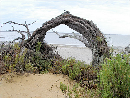
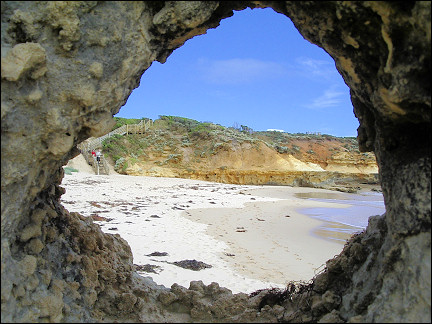
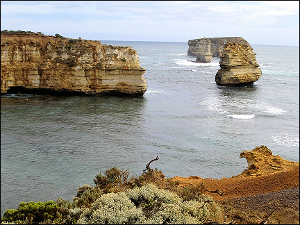
The road winds along the windy coast. The wind and the sea have shaped rocks into fantastic contours, no longer attached to the mainland.
|
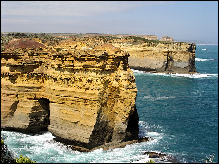
Signs alert us to beautiful spots. When we follow one of them, we arrive at an observation point with a stunning view of gigantic rocks that rise high above the sea.
We walk to the beach. Ton is taken by surprise during a photo session by a huge wave and thrown on the rocks. His camera and glasses fly in the air. Luckily he succeeds in avoiding the next wave and at the same time save his glasses and camera with an athletic move. He gets away with only a wounded leg.
|
Nest morning the sky is overcast, even though tonight it was full of countless stars. The constellations are different from the ones in Europe. The clearest constellation is the Southern Cross.
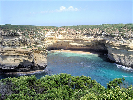
We visit Port Campbell National Park with its Shipwreck Coast, a 32 km stretch of ocean coast with rocky islands, hundreds of isolated inlets and bays with deserted beaches.
|
Meanwhile the sky is clear blue. To reach the sights, we have to take short walks through dune areas, where we are attacked by horseflies.
But at the end of every walk we are rewarded with views of rocks rising high from the sea. Some cliffs are 70 meters above the sea, which pound them violently. Some rock formations have collapsed into the sea over the last few years.
|
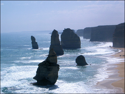
Finally we reach the famous Twelve Apostles, twelve solitary rocks rising from the sea a short distance off the coast. From where we are standing, we can only see seven of the rocks. While we walk back, an echidna - a kind of porcupine with a pointy snout - passes us by without paying any attention to us.
Today we just drive, we pass Melbourne by and go inland to the high mountains. The roads here are often worn away in the bends by the huge trucks we see. They are twice as high as our mobile home and often have a second trailer. Very intimidating and they drive extremely fast.
|
Our next destination, Kosciuszko National Park, is too far away to reach in one day, so we take it easy: 200 km on the M 31 to Ebden near Wodonga, close to the border of New South Wales.
Left and right of the highway we see vast yellow fields. Cows and sheep are in great numbers quenching their thirst at the watering wells, in the shade of big trees. The temperature is 40 degrees Centigrade.
New South Wales
Charred remains of a gigantic forest
Next day we arrive in Mt. Kosciuszko National Park in a short time. We are now in the province of New South Wales. The roads here are narrower, steeper and have more turns. It is quiet on the road, though. Sometimes we meet nobody for half an hour.
|
We cross the park from west to east and take the northern route along Mt. Kosciusko. The GPS indicates that we eventually reach an altitude of 1680 m. On the highest point we have a view of the mountains in the park which is almost as big as Holland in its entirity.
Kosciuszko Park is supposed to be rich in vegetation: hundreds of thousands of acres of eucalyptus trees, pine tree forests, ferns and great amounts of animals as well.
|
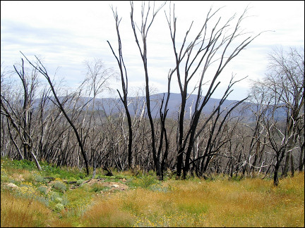
But there is nothing: we drive for three hours in a charred moon landscape. Last year forest fires destroyed this nature reserve almost in its entirity; we only see charred remains of trees.
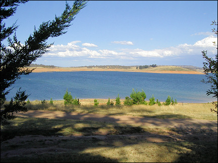
On the Snowy Mountains Highway we turn south to reach our destination of the day: Old Adaminaby. The high-lying part of the village serves as a camping site, on Lake Eucumbene, one of the many reservoirs in this area that produce electricity for a large part of East Australia.
|
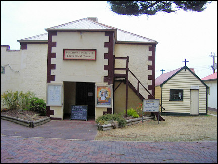
There is a sunken village in the lake; only the church and the village school still rise above the surface. The old school (1890) serves as the reception of the camping site. A few kilometers ahead, a new village was built.
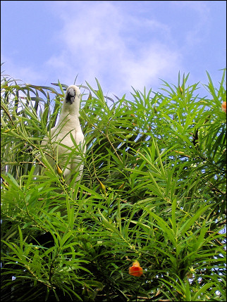
On the deserted camping site we find a spot with a view of the gigantic lake. In a tree behind us white cockatoos enjoy a meal of denapples. Beautifully colored Australian parakeets fly everywhere.
Next morning screaming cockatoos wake us at 7 am. We drive back to the coast. During the first half hour we are still at an altitude of 1200 meters. As far as the eye can see the landscape is yellow. Every now and then we see a green patch where a farmer irrigates his land day and night.
Then we dive into the Bega Valley. We drive in first gear, because the road is steep; all of a sudden there is green vegetation. It turns out that a large part of this area is covered by national parks.
The East Coast
Deserted bays and tropical rainforest
|
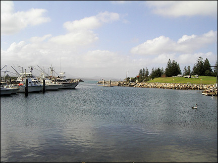
Before we know, we have reached the coast and enter Bermagui, a fishers village on a horse-iron shaped bay in the Tasman Sea, 400 km South of Sydney. The sources of income here are tuna fishing and (fishing) tourism.
|
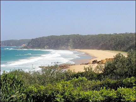
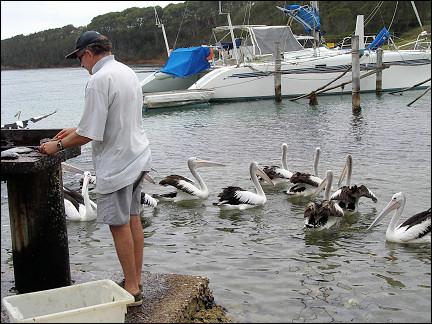
Pelicans swin in Bermagui's harbour. We find a spot on a camping site close to the sea and near the village. In the evening we have dinner in the local hotel. We have oysters, jumbo mussels au gratin, big shrimps, squid, tuna filet and other, undefinable seafood.
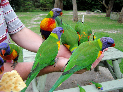
This morning a different kind of bird wakes us: rainbow lorikeets. They are beautiful birds, blue, green, yellow and red, but they make a horrible noise. There are at least 200 of them in the tree under which our mobile home is parked. They scream and eat seeds from the tree all day long. High in the sky floats a white-tailed eagle.
|
We walk along the shore. The sky is clear blue, the sun shines, there is a strong wind, there are big waves and the beach is deserted. After every bend a new bay appears in a different shape. The only living beings apart from us are the sea gulls.
On the way back we pass by the Blue Pool, carved out in the rocky bay, on the edge of the village. The pool is filled with seawater which flows into it whenever there is a strong wind. If the wind is very strong it is not permitted to swim here, because the waves could pull you over the rocks into the sea.
|
We travel farther north on the Princess Highway, which winds its way through forests along the Tasman Sea coast. The names of the towns we pass through suggest that Aboriginals used to live here: Narooma, Mullimburra, Moruya, Burrewarra and today's destination, Ulladulla.
|
Nowadays only few of them still live here, they are recognizable by their dark skins and characteristic faces. By the end of the afternoon we arrive in Ulladulla. Our camping site again turns out to be a rainbow lorikeet habitat. They are so tame they can be hand-fed.
We leave Ulladulla early for Kiama, our last stop before Sydney. We only have to cover 100 km today, so we have time to stop on the way.
|
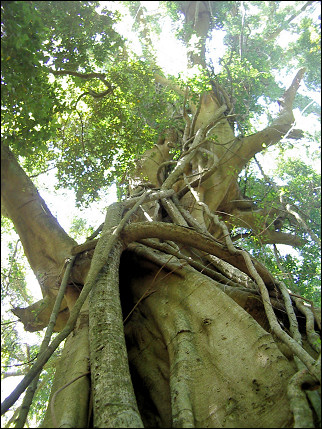
We drive inland to Budderoo National Park, where we hike in the Minnamurra rainforest. Half-way the road gets steep, to end up at the Minnamurra Falls. Although we're not in the subtropics, in the course of centuries a tropical rainforest grew here.
We walk for hours along the roots of cedars which tower high above us, meters high ferns and lianes. Unfortunately the animals are hiding from the heat.
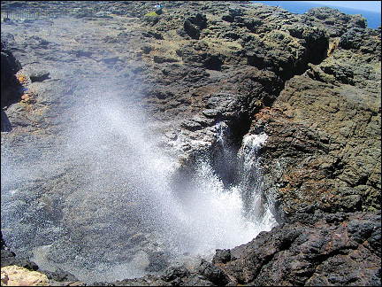
Late in the afternoon we find a spot on the camping site near Kiama, wich lies on a finger of land, near the lighthouse and the village's main attraction: Blow Hole.
|
Blow Hole is a big hole in the rocks through which - on the seaside - seawater is pressed with enormous force, making it spout 60 meters up with a loud bang.
Kiama is named after the blow hole: Kiaram-a is an Aboriginal word which means "where the sea makes noise."
|
We rise early and run on a 8.7 km hiking trail along the camping site. It is a hilly route with views.
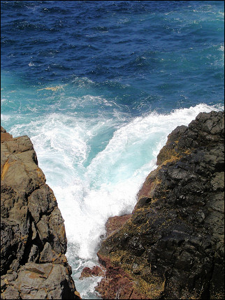
The sea pounds the shore and sometimes the water splashes meters high. The splashing water combined with the rising sun makes for beautiful rainbows.
The only sounds we hear are birds and the waves pounding the shore.
After swimming in the pool between the rocks we leave for Sydney.
It takes us only one and a half hour to reach Ramsgate, 15 km from downtown Sydney. Buses and trains are available to take us to Sydney.
Sydney
Climbing Sydney Harbour Bridge
|
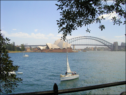
Including waiting for buses and trains it takes us an hour to reach Sydney Harbour at Circular Quay where the ferries are. He we have a view of the Opera House and Sydney Harbour Bridge.
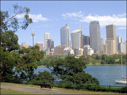
We board the Sydney Explorer, a bus that drives along the city's sights. We visit Sydney Aquarium, near the last stop. With its enormous sharks, rays, giant turtles and big fish it is impressive.
Next we visit the Queen Victoria Building, the prettiest mall in the world. It was built in 1898 in Byzantine style as the central fruit and vegetable market in the city. It has been renovated into a mall with 200 stores, everything in the original style.
|
Next morning we take the ferry to Manly, a town with beautiful beaches on the passage to the ocean. The ferry is fast, but it still takes 35 minutes to reach the other side. Meanwhile we have a view of Sydney's natural harbor.
We take the same ferry back and then board the monorail, which winds through the city. We get off at Paddy's Market. This is an indoor market: clothes, shoes, food, fish, flowers and assorted junk.
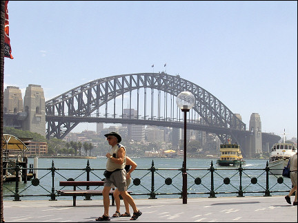
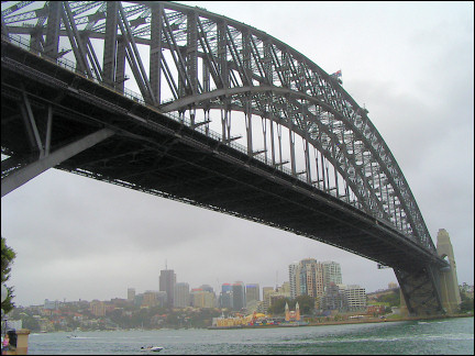
Later in the afternoon we sign up for the Sydney Harbour Bridge Climb. It is the longest and highest bridge with one arch, built between 1924 and 1932. It has a span of 503 meters; it's length including ramps is 1149 meters, it is 49 meters wide and its highest point is 134 meters above the water surface.
|
The climb takes three and a half hours, including one and a half hour of preparation. We have to take an alcohol breath test, sign a statement regarding our health, lack of vertigo and declare that we climb the bridge at our own risk.
Everything has been done to minimize the risk. We are not allowed to take anything with us and have to wear coveralls (wind tight and no pockets). We wear belts to which a rope is attached with an ingenious instrument which allows us to pass all obstacles on the steel cable to which we are secured.
We practice and then the real thing begins, our hearts pound. The first 30 meters, until we reach the arch, take us up on steep, narrow stairs. Traffic races next to us at a distance of only a few meters with 100 k.p.h., the steps are open (grid) and beneath us, over 70 meters lower, the water moves restlessly.
|
What follows is the relatively easy part, the arch. It isn't as steep and you can't see through the steps. The view is breathtaking. The sailors on a 40 meters long ship that passes under the bridge look like Lego dolls.
At the top we see Manly, where we went this morning by ferry. We cross to the other side of the bridge, where the flags of Australia and New South Wales fly. There we begin our descent.
On the other side we notice that the harbor goes a long way inland. The last part of our descent is very steep again.
Blue Mountains
Mountains, waterfalls and vast eucalyptus woods
|
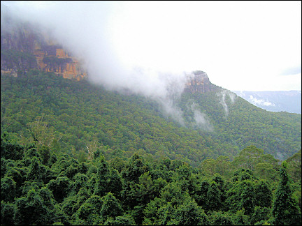
There was rain and thunder all night long. Today we travel to the west, inland, to National Park The Blue Mountains. Katoomba is our destination, only 110 km from Sydney, but a completely different environment: mountains, steep depths, waterfalls and vast eucalyptus woods.
Katoomba is completely obscured by clouds and the temperature has dropped to beneath 20 degrees Centigrade. It drizzles.
|
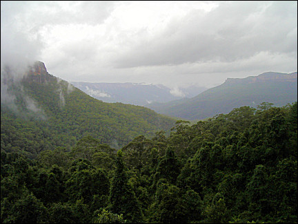
After breakfast next morning it starts to rain again. Before we go for a walk, we complain about the weather to the owner of the camping site. She says we're lucky: "This is real Blue Mountain weather, mates."
Despite the rain we take the 7 km Prince Henry Cliff Walk (7 km) with views, waterfalls and narrow paths through the rainforest. We see many different birds.
|
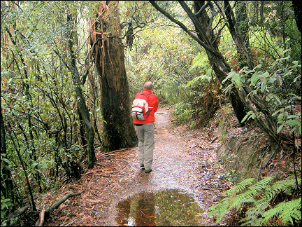
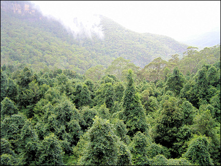
First we descend by train on the steepest railtracks in the world (Scenic Railway) at a 45 degrees angle, 200 meters down. There we walk along mountain slopes in a beautiful rainforest. The path becomes narrower, steeper and inaccessible.
We are literally walking with our heads in the clouds and hear invisible birds. The gorgeous surroundings are soothing. The cloud patches trying to rise over the mountains are breathtakingly beautiful.
|
After about an hour we are stranded, the distances between the stone "steps" on which we are walking, become too big, half a meter.
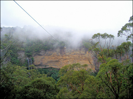
Back at the beginning we take the boardwalk, a 2.2 km long wooden path to the cable lift which takes us back up. It has stopped drizzling, the rain is now torrential. The camping is completely obscured by clouds.
|
Next day it rains cats and dogs. And a depression lasts for four days here, without any let-ups. We flee the Blue Mountains.
Byron Bay
The most eastern spot in Australia
We take the tourist route to the north through Wollemi National Park. As usual this route meanders through 170 km of stunning mountain landscape.
Half way Ton almost hits a turtle; he jerks the wheel to the left and the turtle retracts its head and together they prevent a tragedy. But we won't wager an Australian dollar on the life of the turtle: in the rear mirror we see two big trucks approaching...
|
After a long day of driving we arrive in Bulahdelah, a small town on the Pacific Highway, 250 km north of Sidney, where we spend the night.
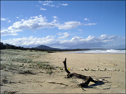
Today we follow the Pacific Highway farther north. It is still raining, but the sky doesn't look as grey as before. Already after a few kilometers we leave the highway for a tourist route. It takes us over mountains, along swamps, lakes, vast forests and isolated farms (often for sale).
|
We drive for hours until we see the Pacific again. Just before we enter Nambucca Heads (our destination today) we visit a garden with lots of indiginous animals, of which the koala is the main attraction. We arrive exactly at the right time, because koalas are active only for a few hours every day.
It's strange that they breed koalas here, while they are neutering them on Kangaroo Island.
|
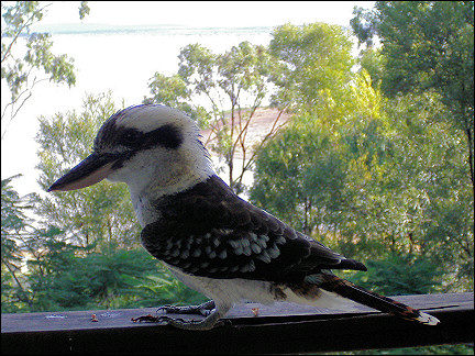
Late in the afternoon we arrive at a camping site. While we are eating dinner outside, kookaburras beg for food; they're not interested in bread, only meat is good enoug.
After breakfast we drive farther north on the Pacific Highway through a varied landscape. On the way we eat a sandwich in Ulmarra, a village with 300 inhabitants where time has stood still for 50 years. The houses are made of wood and have porches and the big billboards sport 50 years old ads.
|
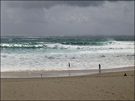
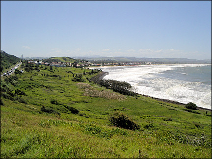
Our destination is Byron Bay, the most eastern spot in Australia. It is tourist season all year round here. There are thousands of, mostly young, surfers. The waves are impressively high; it's wonderful to watch the surfers on the waves.
This 6503 km trip in Australia continues From Brisbane to Cairns. On the way there and on the way back Malaysia was visited: Kuala Lumpur and Penang